As evidenced by archaeological research, Servia and its wider area have been inhabited since the middle of the 7th millennium BC (6430 BC). The settlement remains of the Earliest Neolithic period (6500-6000 BC) was discovered at the sites of Varemeni Goulon and Paliabela Roditi. At the latter site, a burial of a small child in a pit also came to light. Nine other settlements also belong to the same period. The site of Kasiani Lavas is the highest settlement of this period in Greece, at an altitude of 950m.
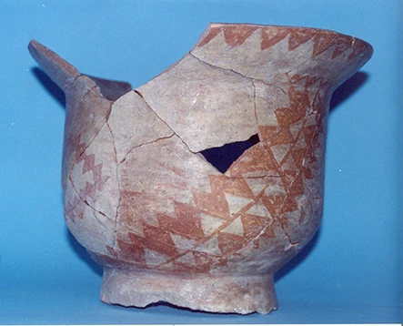
Eleven settlements are dated to the Middle Neolithic period (6000-5500 BC). The primary and most extensive excavation is associated with the ‘prehistoric settlement of Servia’ and was carried out in 1930 by W.A. Heurtley and in 1971-1973 by C. Ridley, K.A. Wardle, and A. Romiopoulou. The architecture of the settlement included large beam and column buildings. Although now destroyed by the lake, another significant Neolithic settlement of the valley seems to have existed at Kryovrisi of Kranidia.
The Late and Final Neolithic period (5500-3000 BC) is characterized by an increase in the number of sites exceeding 28. High hills and caves, such as the cave of Neraida, were preferred during these periods. The settlement remains of the period were excavated in Servia, Varemeni Goulon, Gorge of Messiani, and Paliokastania of Servia. A cremation burial of the Late Neolithic, from the settlement of Goules, is the only burial evidence of the period.
About 20 settlements date back to the Early Bronze Age (3000-2000 BC). The three excavated ones, “Settlement of Servia,” Gorge of Messiani, and Kasiani Lavas, brought to light dismantled architectural remains.
The settlements of the Middle Bronze Age (2000-1600 BC) known so far are located at Messiani Gorge, Turla Goulon, and Neraida Bridge. The only excavation of the period revealed a cemetery located at Turla Goulon, 300 m from the aforementioned settlement, to which it probably belonged. Forty-four graves were investigated, of which seven belonged to children.
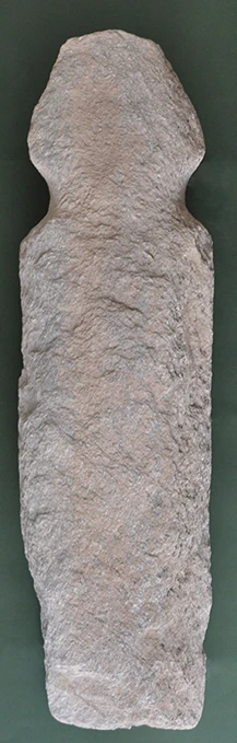
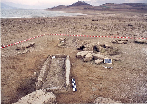
The characteristics of the 37 Late Bronze Age (1600-1100 BC) settlements suggest a different socio-economic organization. The settlement remains, destroyed by the lake, were investigated at the site of Skamnies in Servia. The findings suggest buildings made of simple materials, perhaps wood. At Kryovrisi Kranidion, eight cist graves belonging to a small eroded cemetery were also investigated. To construct four of them, 11 intact or fragments of stone anthropomorphic columns, probably Neolithic were reused.
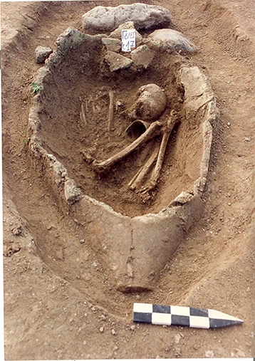
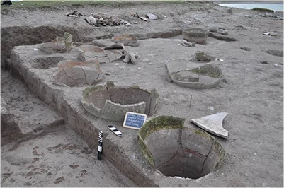
In the Early Iron Age (1100-700 BC), 18 settlements and six cemeteries are known. Some of the sites show characteristics of central settlements. One of them was excavated at the eroded site of Paliokastania in Servia. Parts of three pitheonas were investigated, the largest consisting of 20 pithoi, as well as a stone-built arched building. The burial remains of the period mainly include burials in cist tombs. A few graves were investigated at the sites of Kolitsaki and Kokkinoi in Servia and at two sites in Trigoniko. At the same time, three pottery vessel burials and an enchytrism of a small child from the site of Kryovrisi near Kranidia testify to the parallel use of other burial practices.
Remains of the Archaic and Classical periods have not been found in the area so far, except for a few indications of their existence in the Messiani Gorge.
There are currently 31 known sites of the Hellenistic period, the most important of which are Platania Gulonia, Kryovrisi Kranidion, Bridge of Servia, Neraida, Castle Patsioura of Lefkara and Paliabella Vathylakkou. Three more settlements are located in the mountainous area of Lava and Kastania. The cemeteries of this period are 7, most of them eroded by the lake. Of these, only two eroded pit graves were excavated at Platania Goulon and one at Agia Varvara of Servia.
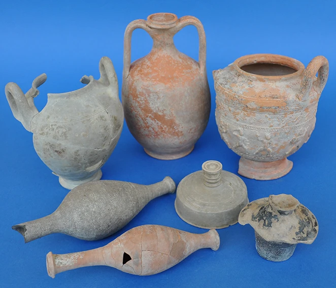
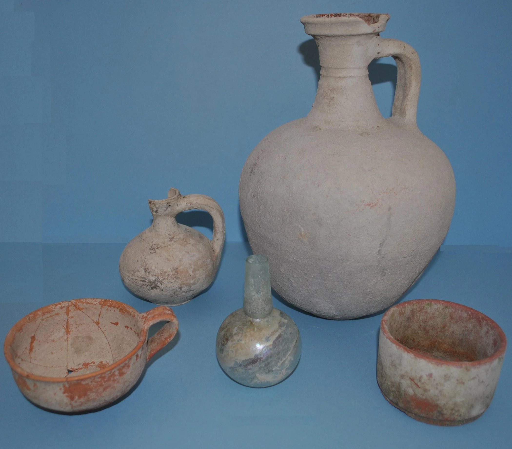
In the Roman period (30 BC – 300 AD), 14 settlements and six cemeteries have been found. Two of them stand out at the sites of Kolitsaki of Servia and Kastro Patsioura of Lefkara, which could be considered significant. Cemeteries of the period were found at six sites, all eroded by the lake. The excavation at Kolitsaki of Servia examined about 30 graves, pit-shaped with or without covering slabs and a tiled roof. A cist grave was also excavated at Agia Varvara of Servia, and eight pit tombs were excavated at Palea Asfaltos Roditi.
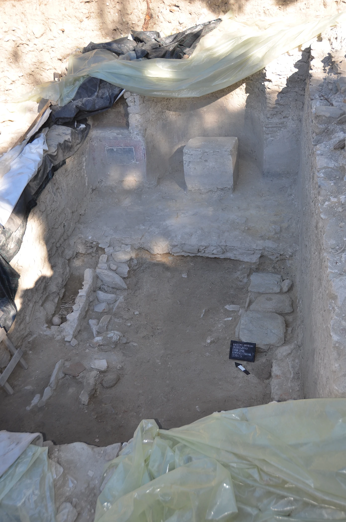
In the Christian period (300 AD and onwards), fifteen settlement sites and nine cemeteries can be dated. The excavations brought to the fore three eroded cemeteries at the sites of Kolitsaki Servia (32 graves), Mortatza Rachi of Aulai (3 graves), and Paliokastania of Servia (one grave). In the castle of Servia itself, the excavation research is limited to the research carried out in the context of restoration works without having a systematic character.
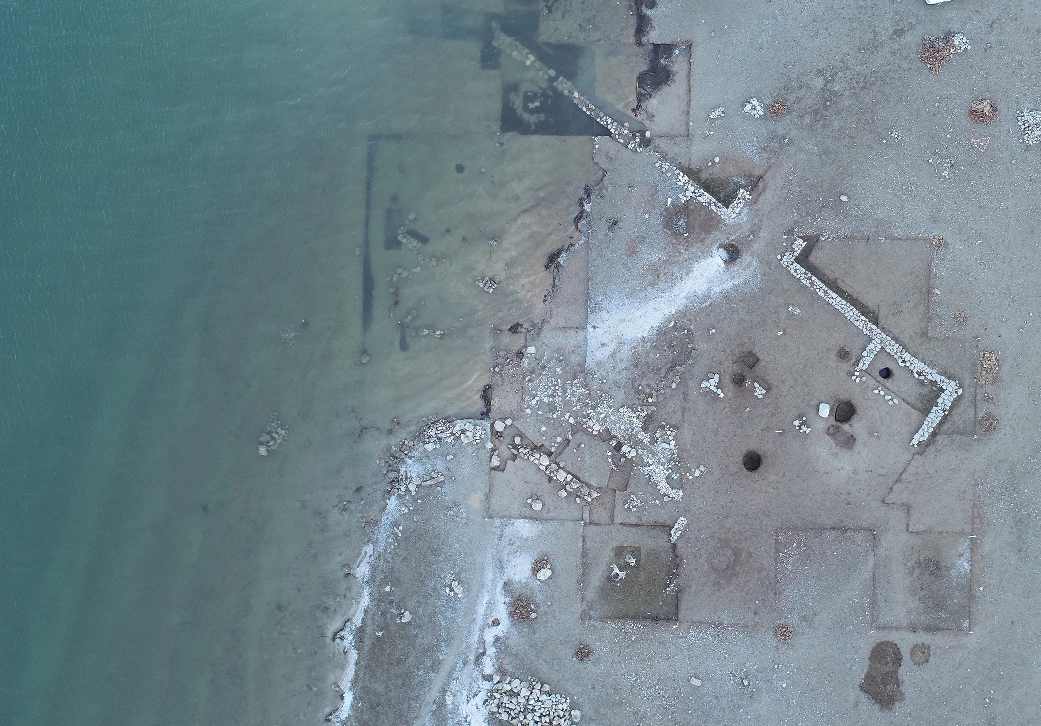
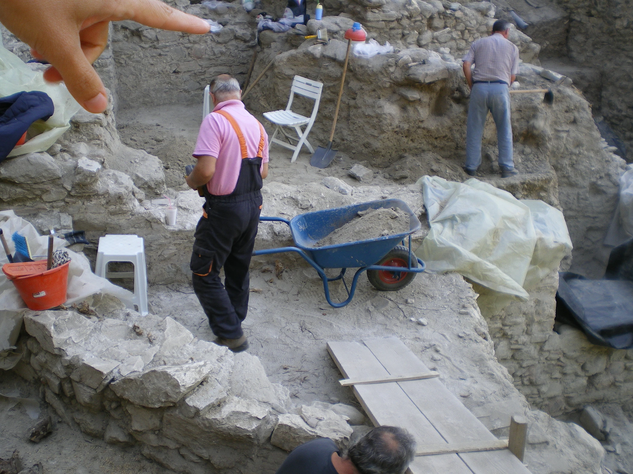
A decisive role in the archaeological research in the area of Servia was played by the fact that from 1974 onwards, the valley of the middle course of the Aliakmonas was flooded by the waters of the artificial lake Polyfytos, dissolving a large number (149) of previously unknown archaeological sites and thus dictating an extensive rescue archaeological research. From the excavation and surface data of this research, which is still in progress, one can draw the following conclusions: in the geological basin of Kozani – Servia there is a dispersion of Hellenistic sites of habitation or occasional use in all geomorphological and altitudinal environments, while in all cases the sites are adjacent to water sources. No Hellenistic fortifications have been found in any of the cases, while no prehistoric sites have been found to have stone-built boundaries. Based on the available evidence, the dry-stone walls or walls found on natural fortified hills – “castles” should be disconnected from the prehistoric and Hellenistic periods and placed in a later period of instability, raids, and conflicts, from the late Roman to the early Byzantine period.
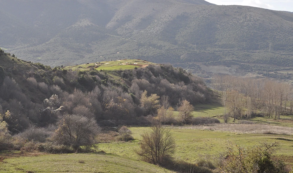
However, some extensive and important settlements can be observed in the riverside area. To the right of the course of the Haliacmon are the settlements of Platania Goulon, Kryovrisi Kranidion, and Skamnies of Servia, at a distance of 5 km from each other, and Kato Bravas of Velventos, at 7,5 km. On the left of the Haliacmon, Aiani stands out. At the same time, at a distance of 12 km, in the area of Messiani, Neraida, and Servia, there is a concentration of settlements, indicating a single, significant settlement. The sites that give the impression of central settlements or towns are located on high hills that are formed into plateaus and occupy a prominent position in the valley. This particular geomorphological choice predicts their importance during the Hellenistic period (at least) and possibly played an essential role in forming the fortified settlement of Byzantine Servia.


The creation of this website is part of the implementation of the Act “Consolidation and Restoration of the Western Tower of the Castle of Servia,” which was implemented by the Ephorate of Antiquities of Kozani and co-funded by Greece and the European Union / European Regional Development Fund through the Operational Programme “Western Macedonia” of the NSRF 2014-2020.