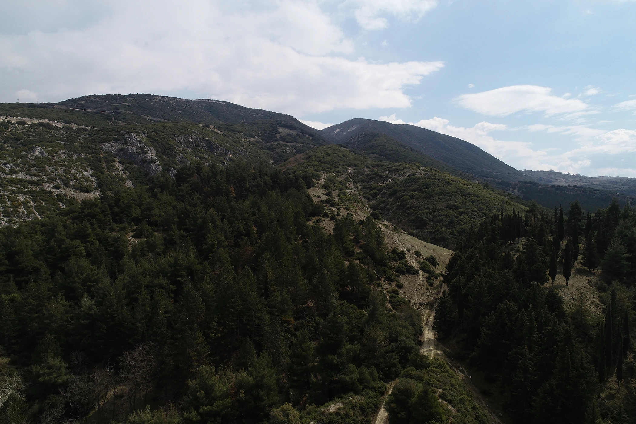
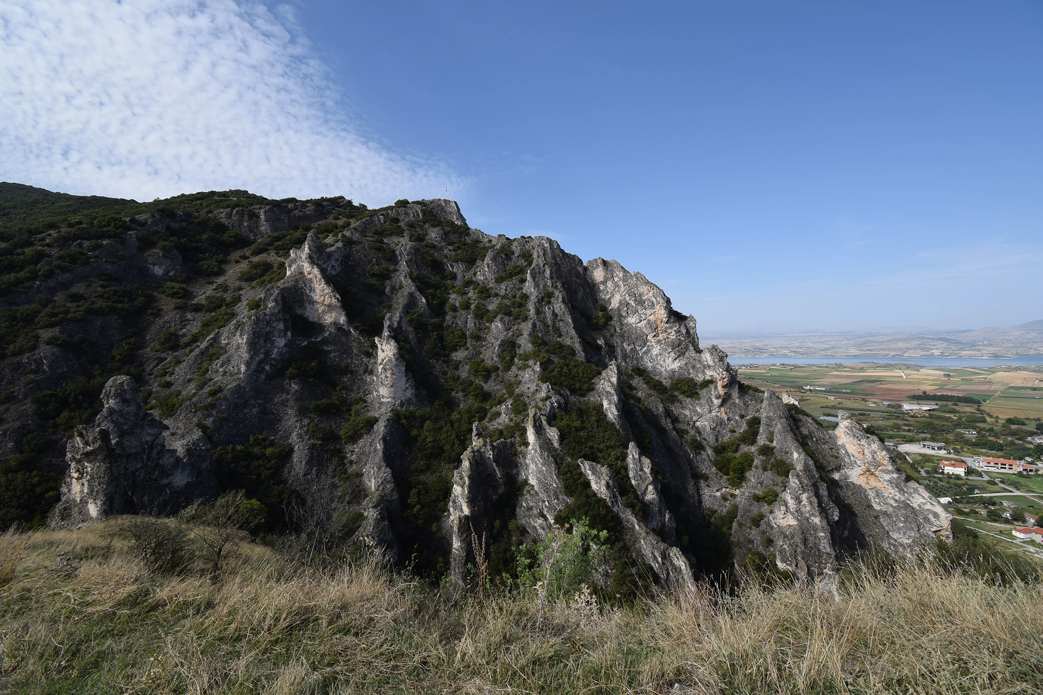
On the southwestern side of the present-day town of Servia, almost untouched by time, lies the archaeological site of the Byzantine Castle City of Servia. The choice of this location to establish a castle was not accidental. At the western end of the Pieria mountain range, the castle of Servia is built on a crucial naturally fortified site, occupying the eastern one of two twin hills that rise above the valley of Haliacmon River, part of which is now submerged by the artificial lake of Polyphytos. Deep limestone gorges surround the area chosen to be fortified: to the west, the gorge of Chouni separates the hill of Servia from the Kamvounia Mountains, while to the east, the gorge of Saint George, which takes its name from the cave church of Saint George, separates the hill of the castle from the foothills of Mount Titarion.
The hill of the Byzantine castle dominates the fertile plain of Haliacmon, overseeing a geomorphological aperture of the mountain range, which was used historically as a passage between Macedonia and southern Greece, leading to the Sarantaporos straits. The visitor to the archaeological site quickly understands the privileged position of the Byzantine settlement of Servia. Controlling the passage of an otherwise impenetrable natural boundary between two regions, Servia had privileged access to the rich hinterland of the Haliacmon Valley, which could provide its inhabitants with the necessary agricultural and livestock products. At the same time, the region’s geomorphology, with its steep mountains and deep gorges, was the ideal geostrategic background for creating a settlement in this area.
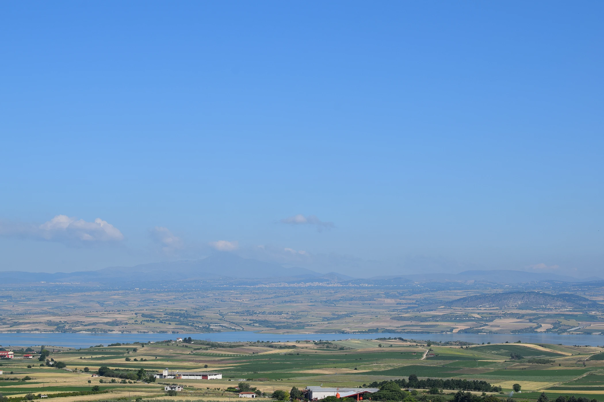
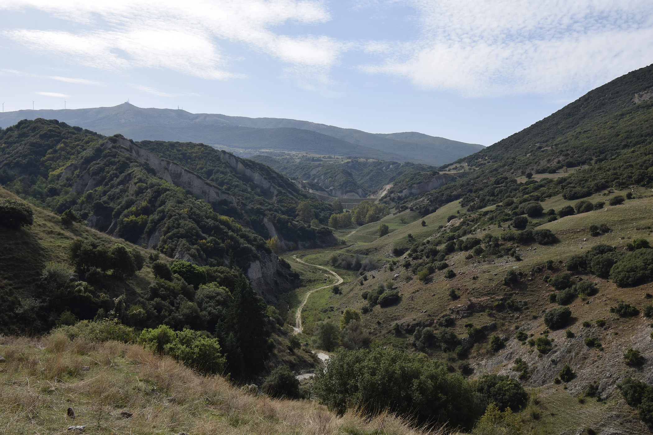
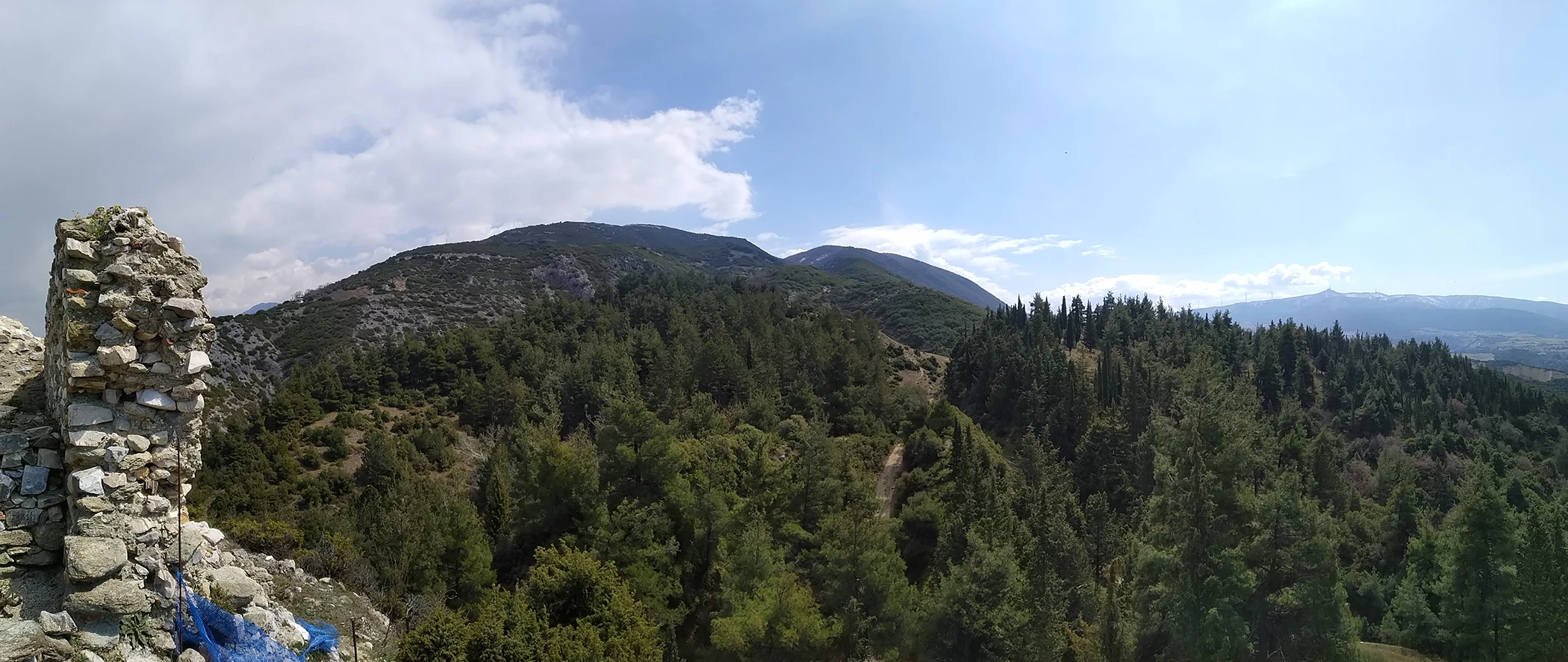
The broader area of Servia is still today a destination where the visitor can enjoy a natural landscape of exceptional beauty without major interventions by man (except for the creation of the dams and the artificial lake). The area’s geomorphology, with many streams flowing into the Haliacmon River, forms successive clusters of hills and slopes between the more extensive mountain ranges and plateaus.
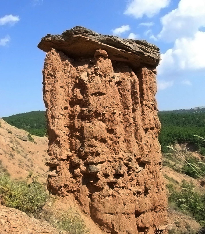
Water is the dominant factor that has shaped the natural landscape. The flows of torrents and rivers, concentrations of water, and drainage valleys form a fascinating natural landscape complemented by artificial lakes. Time is the second element that has shaped the area’s natural landscape. Unique are the natural geological formations in the shape of earthen pillars created by the combination of the elements of water and time.
These formations, visible from the archaeological site of Servia in the neighboring mountains, become larger and more impressive in the Kamvounia Mountains, which inhabitants call ‘boucharia,’ evoking chimneys of supernaturally sized houses. More than twenty such columns can be found in the area of Mikrovalto, ranging in height from two to six meters. The ‘nochtaria’ are similar conical superimposed formations, alternating with the bucharia, forming a unique natural landscape. The ‘nochtaria’ differ from the ‘bucharia’ in that they are not crowned by slates at the top.
In the area, at a distance of about one kilometer from the stream of Potamia, a Geopark has been created in Mikrovalto, near Servia (located at the third kilometer of the Mikrovalto – Livadero road), where visitors can enjoy it in combination with a tour of the post-Byzantine churches in the areas of Tranovalto, Voggopetra, and Livadero. This area is part of the Grevena-Kozani Geopark “Tithys,” one of the six recognized Geoparks of Greece included in the Unesco World Geoparks Map. This Geopark covers an area of around 2500 square kilometers, with the Haliacmon River being the connecting thread between the various points of interest. The archaeological site of Servia and the post-Byzantine monuments of the Pieria and Kamvounia mountains are in direct contact with nature and provide an excellent opportunity to enjoy art and religious spirituality paired with the area’s unique natural landscape.
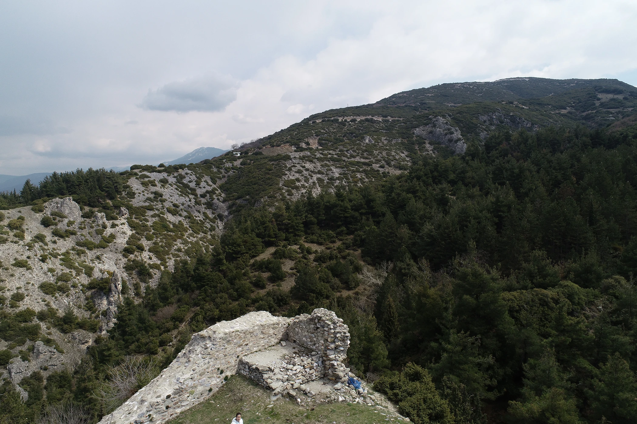
However, it’s not only the wider area of the Municipality of Servia that is of naturalistic interest. The archaeological site of the Byzantine city of Servia itself is in direct contact with the natural environment, overseeing the Great Gorge of Servia, which the locals called “Chouni.” In this gorge, water and the erosion of limestone rocks have created impressive rock formations that have occasionally captured the imagination of the locals who have seen human and animal forms in them, incorporating them into their folklore and local beliefs. As local historians and folklorists mention, Chouni was a hub of demonic and magical forces. The supernatural elements created by the imagination of the locals, combined with the magnificent natural landscape of lakes, streams, large mountain ranges, and, of course, the ruins of the Byzantine castle, result today in a unique setting where historical reality is blended with a unique mixture of local traditions.


The creation of this website is part of the implementation of the Act “Consolidation and Restoration of the Western Tower of the Castle of Servia,” which was implemented by the Ephorate of Antiquities of Kozani and co-funded by Greece and the European Union / European Regional Development Fund through the Operational Programme “Western Macedonia” of the NSRF 2014-2020.